By Paul Hubbard
What is NOAA?
NOAA is the National Oceanic and Atmospheric Administration, a federal agency dedicated to environmental science. This includes climate, localized weather, oceans and coastal areas, navigation, etc. Its website is huge and can be very intimidating. If you have some time to spend on a cold day when paddling is not an option, it can be fun and informative to go through the NOAA web site and look at the variety of resources that are available to us.
As paddlers we depend on NOAA to provide information about marine weather, tides and currents, charts and navigation tools, and other resources. NOAA maintains the database for all of the tidal data that is gathered across the nation’s waterways. While there are many web sites that provide tide and current information, all of the raw data is actually provided by NOAA.
Learn about Tides and Currents
The NOAA website is an excellent source of information for anyone wanting to learn about tides and currents. You can go as deep into these topics as you want. There are multiple links on the site to educational resources on many different topic. Check the page on Tides and Water Levels for information on tides. In addition to learning what causes tides and how data is collected, and the history of monitoring the tides, you can also find real time, historic, and predictive tidal data.
Using NOAA for Tidal Data
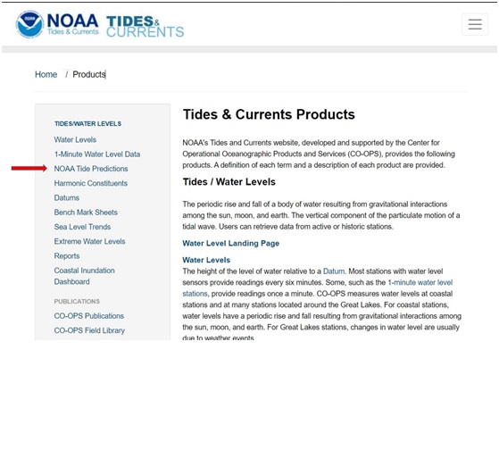
Sometimes navigating the NOAA web site is like paddling through a marsh without a chart. There are multiple menus and some seem to take you in circles. For convenience I am providing several direct links to the pages that are most useful to us as paddlers. The first is the Tides and Currents Products Page. This page includes links to help look up information on tides and currents as well as a link to the tidal prediction page. Anyone who is interested in the science around tides and tidal currents can learn an incredible amount from the information available here.
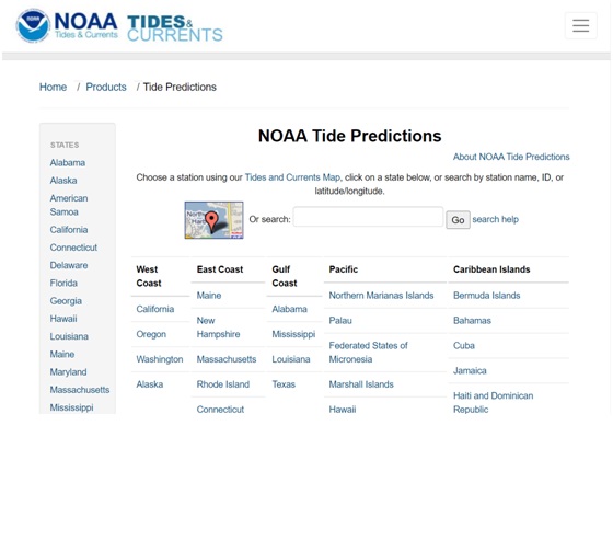
If you are just looking for the tides at a specific location for example when you are planning a trip. Follow the link to the NOAA Tide Predictions page. This will give you the options of looking up a tidal station from a Map interface, search for a station if you know its name, or scroll through the stations by state. Clicking ‘About NOAA Tide Predictions’ will take you to a detailed user guide on how to get the information you want and additional links to a FAQ page.
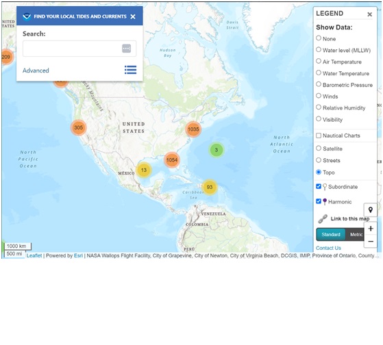
Let’s decide that it’s going to be a beautiful day to paddle on New Year’s Day, at least from where I’m sitting. The temperatures will be unseasonably warm, and you have all of your cold water gear tested and ready. You want to paddle in Annapolis and you want the tidal information. You have a choice to search using the map interface or locating the station. Let’s choose the Map interface. This first takes you to a map of the entire US. To narrow it down, you can either search by station ID, city, state or zip code, or adjust the zoom until you see the area of interest.
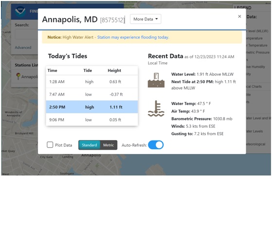
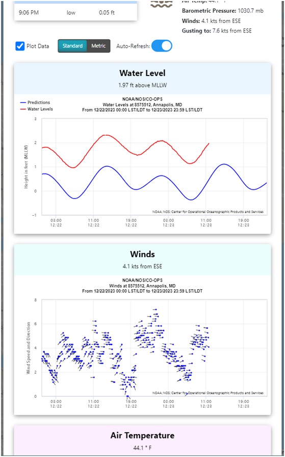
Since we know we want to paddle in Annapolis we decide to search by city. As soon as you type the first three letters, partial matches will be listed. Keep typing to narrow the list. We found Annapolis Station listed. When you select the station, the first thing that comes up are the current conditions at that station. This includes any current notifications, current water level, tidal predictions for the day, weather conditions, water temperature, etc.
Then it gets more fun if you click the box to plot data, you get a graph of the recent past and current day predictions of water level, wind, temperatures, etc. The ‘More Data’ menu gives a list of additional information regarding the station. It can be fascinating, at least for a tidal nerd like me to look at the amount of data that is collected from one station.
All this information about today’s tides is great to know, but my paddle isn’t going to happen until next week. How do I get to the tidal predictions from here?
First we can go to the More Data menu, then select Tide Predictions. This will bring up the tidal prediction page that defaults to the current day. Select the desired dates, then click plot daily to get the predictions for the selected date. You will get the graph as well as the text version of the tidal predictions.
So we see that the day of our paddle, High tide is at 8:25 am and low tide is at 2:39 pm.
There are multiple ways to get to the tidal predictions page. I have only outlined one method. The best way to learn more about the resources available on the NOAA site is to take time to explore the links. Another way to learn is to sign up for CPA’s Navigation Class. This class is free to CPA members. If you are not a member, you can join CPA here: https://www.cpakayaker.com/membership/. While you are there, take advantage of the information provided on the website. What differentiates CPA from other paddling clubs is the range of educational opportunities available at low or no cost.
Happy Paddling.
Paula Hubbard
CPA Coordinator.